Illinois Protected Lands include parks, wildlife areas, wilderness areas, wildlife refuges, recreation areas, nature reserves, historic sites, forests, and others that serve a wide variety of roles (e.g., hiking, hunting, nature study) and have various levels of permanence (e.g., 30 year easement, permanent easement, National Forest). Each type of protected land is designed to confer specific conservation benefits (e.g., conservation easement, wildlife refuge, city park) by considering site-specific Natural Community Types (NCTs) and Illinois Species in Greatest Conservation Need (SGCN). However, protected lands are growing increasingly isolated due to landscape modification and require dedicated stewardship to ensure conditions continue to meet site conservation goals and purposes. Efficient allocation of personnel and financial resources is critical for effective delivery of stewardship and conservation efforts within Illinois protected lands.
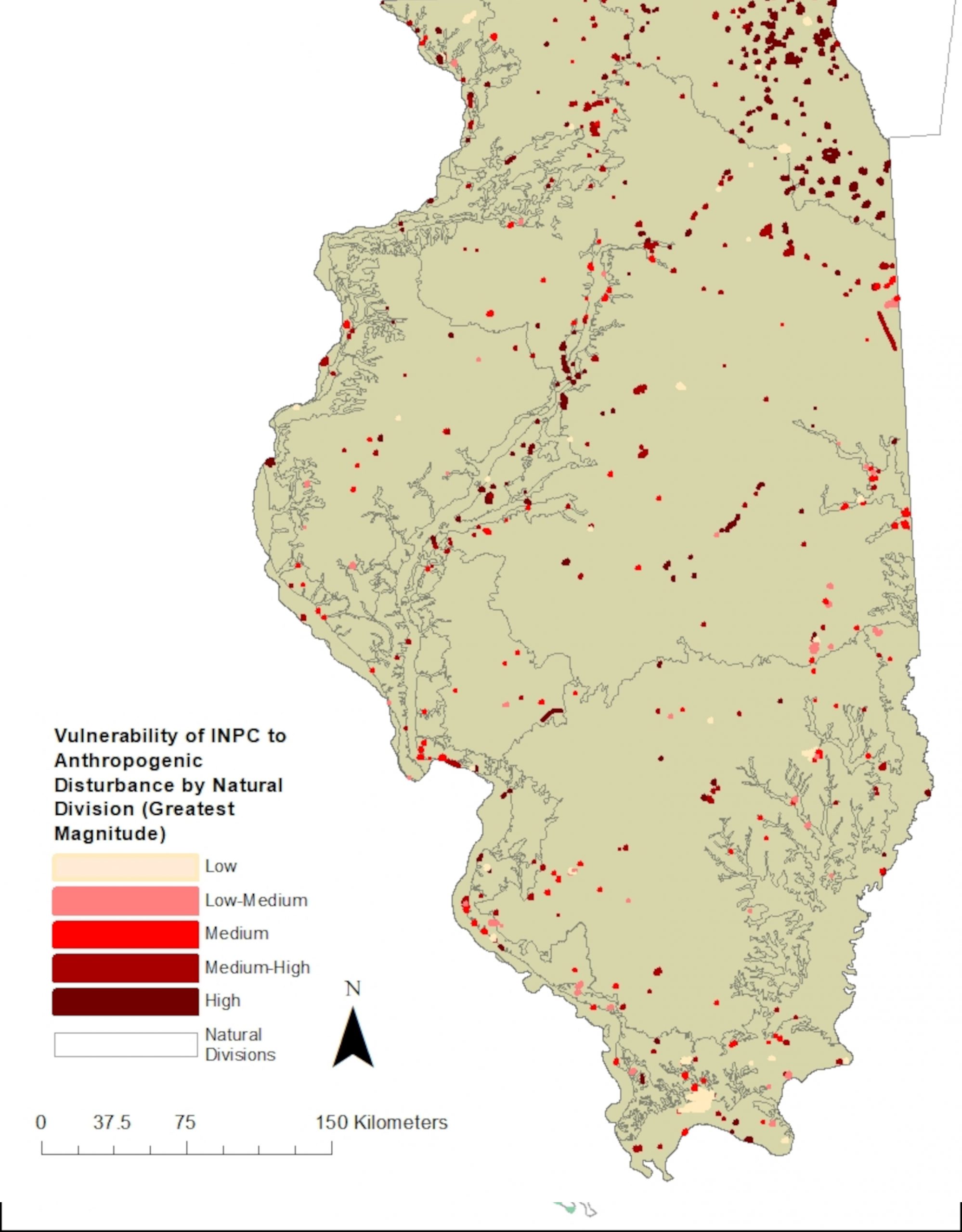
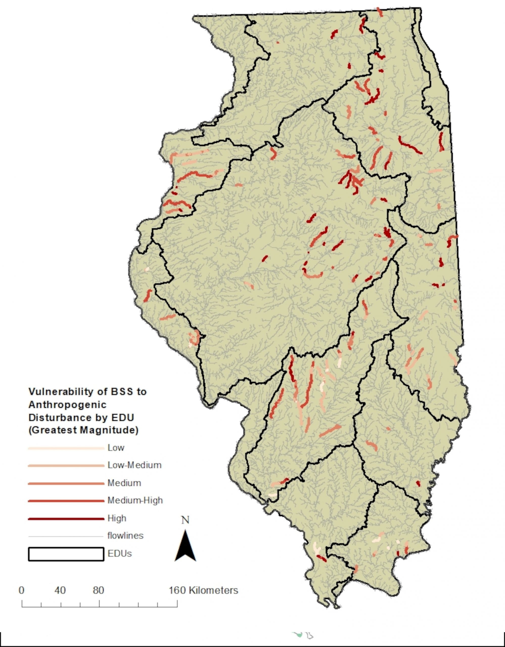
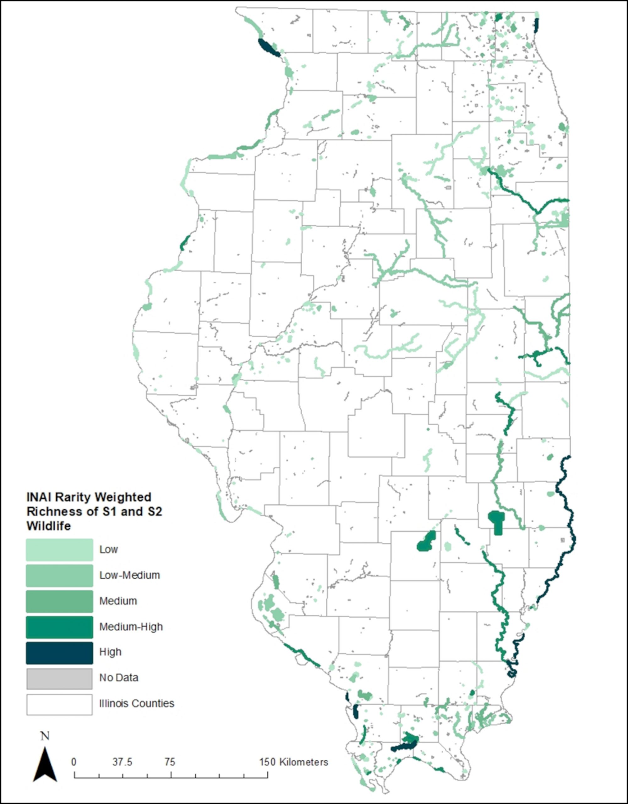
This project aims to prioritize Illinois Nature Preserves, Illinois Natural Area Inventory sites, and Biologically Significant Stream segments identified as Focus Areas within the Illinois Wildlife Action Plan Streams Campaign for protection and stewardship based on NCT quality and SGCN presence. Sub-national conservation status ranks (S-ranks) will be developed for Illinois NCTs and SGCNs, and protected lands of interest will be prioritized relative to their statewide rarity weighted richness, biodiversity, and viability relative to anthropogenic disturbances. Project tools include priority-ranked species and natural communities, as well as site lists and maps of priority-ranked protected lands. Project output thereby identifies key aquatic and terrestrial locations for conservation work, provides common assessment standards for evaluating current statewide protection efforts, and informs conservation manager decision-making and efforts towards meeting regional conservation goals.